Have a gander at the GoogleEarth image below, in which the Texas-New Mexico border runs down the middle.
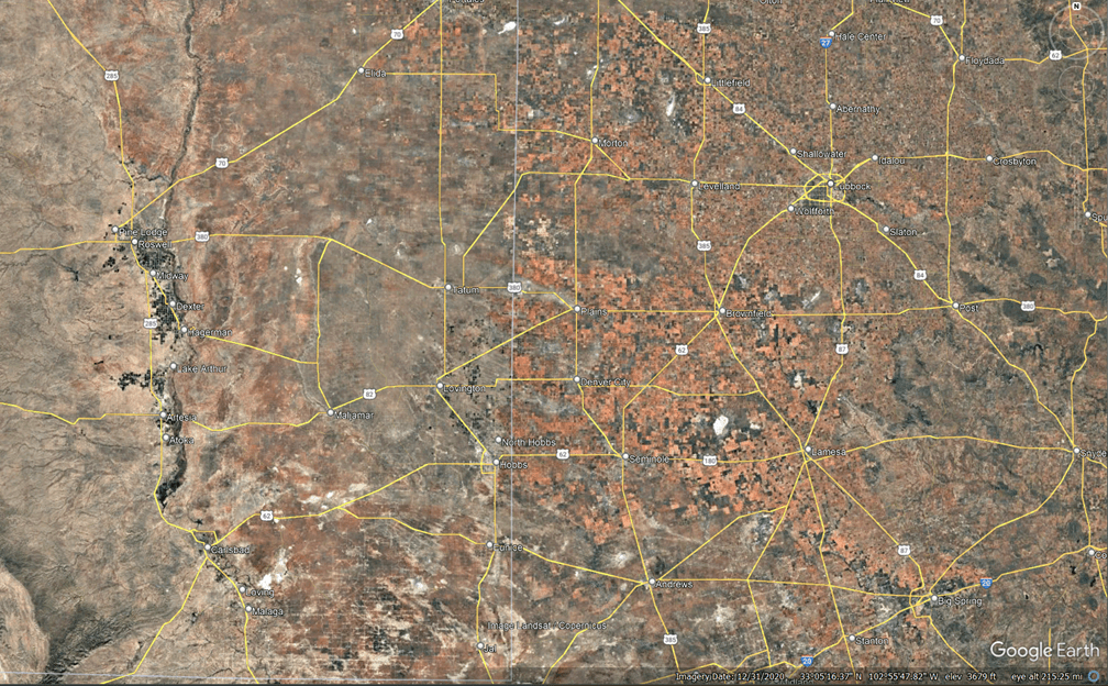
The difference in color, due to irrigation for crops, is the important thing here.
Texas law permits essentially unregulated groundwater withdrawals while New Mexico law does not permit this.
Underlying this area is the Ogallala Aquifer:
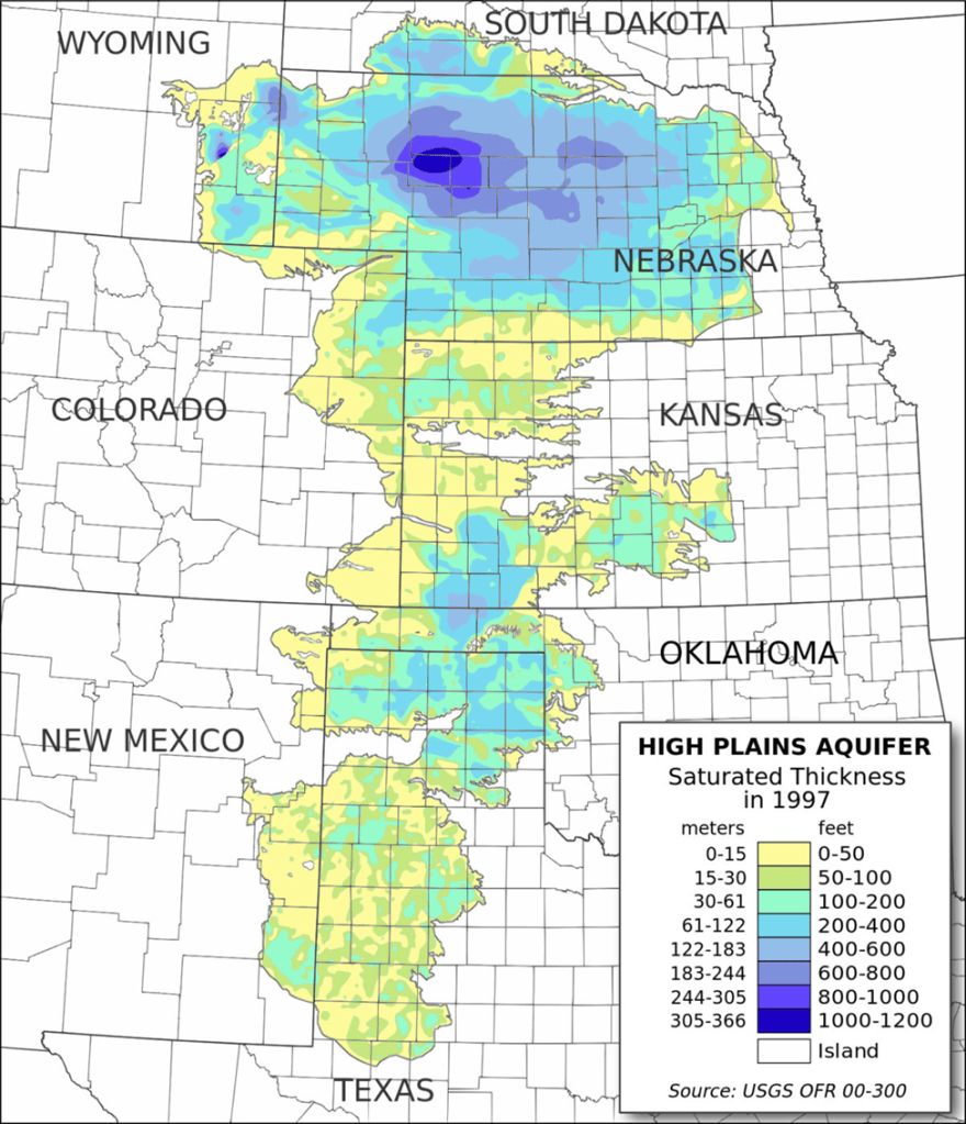
The Ogallala Aquifer is a vast resource. But it’s shallow, and vulnerable to contamination. Parts of the aquifer have high nitrates, and atrazine is widespread.
2016 Evaluation of Groundwater Nitrate Contamination .pdf
That map shows a lot of red and black dots, indicating problematic nitrate pollution, mostly from fertilizers and irrigation with water with elevated nitrates. With inefficient irrigation evaporative losses are significant, and pumping and irrigation are a cycle of evaporation and concentration of pollutants. Add the use of fertilizers to that and…
Wikipedia:
The deposition of aquifer material dates back two to six million years, from the late Miocene to early Pliocene ages when the southern Rocky Mountains were still tectonically active. From the uplands to the west, rivers and streams cut channels in a generally west to east or southeast direction. Erosion of the Rockies provided alluvial and aeolian sediment that filled the ancient channels and eventually covered the entire area of the present-day aquifer, forming the water-bearing Ogallala Formation.
Some of the crops irrigated with this pumped water are cotton, and there are places, perhaps along 287 west of Wichita Falls, where the cotton lost during harvest lines the shoulders like slushy snow. As driving the snowy roads of Wisconsin is hard-wired into my brain it provided quite an effect, and I was transported back to the snowy Wisconsin roads, although parts of brain knew it was oddly warm for that white stuff to be snow. The dissonance was discomforting.
This portion of Texas and New Mexico is also underlain by vast hydrocarbon mineral resources of the Permian Basin, which appears to be a general term for the Midland and Delaware Basins and the Central Platform.
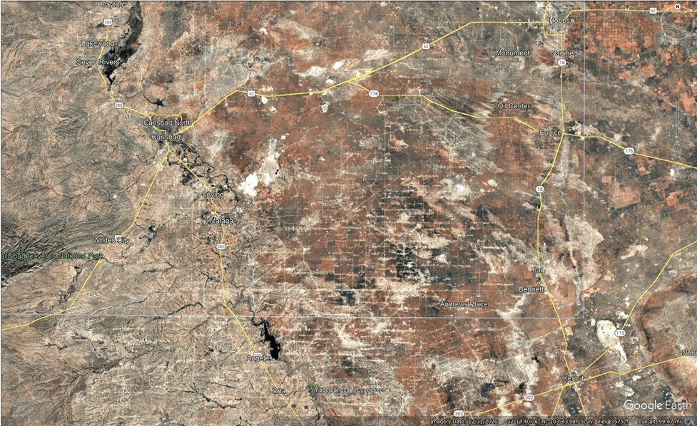
This is to show that oil and gas development clearly has a direct physical impact. Perhaps it is some consolation that this area is fairly low bio-diversity, although the “sky islands” of lonely desert mountain ranges are effectively islands of biodiversity (see my recent post about the Guadalupe Mountains, which are cut off on the far lower right of this image.
The southeast corner of New Mexico is in the lower right. The later streaks are all the impacts of oil and gas production development.
Here’s a GE image of the Texas side of the Permian:
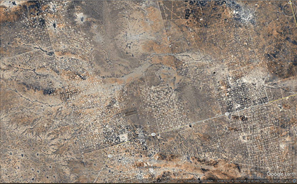
That’s all interesting in terms of land use, as the direct physical impact of the oil and gas industry is incredibly widespread.
It should be noted that these are virtually all private lands.
Driving through the Permian Basin is recommended, just to see one of the most productive oil regions on the planet. Common features are lots of massive trucks, oil rigs in the distance, man camps, compressor stations, water processing facilities and the occasional flare.
On the day I visited, the expansive view of the Basin from the Carlsbad Caverns parking lot revealed a layer of smog concealing the valley floor, through which several massive drilling rigs pierced, accentuated by several flares.
The water pumped from the Ogallala Aquifer is not only used for agriculture, but is also used for fracking water, drilling mud, and cooling water for the massive wind turbines located on the Platform and farther east.
The USGS a drop in the Texas Ogallala (High Plains) aquifer of 41.2 feet relative to predevelopment conditions, with a 10-year drop of 6.2 feet. This will place the expected drop in 2025 to be around 50 feet.
Given that the thickness of the Ogallala is a maximum of 50 feet in much of the Texas portion, we can guess that some wells are going dry. Now there is groundwater below the Ogallala, in some locations, but this requires the expense of drilling deeper wells to access.
As an aside, why is it called the Ogallala? Maybe it’s pertinent to our topic, as it derives from the name of the Oglala Sioux people who now mostly reside at the Pine Ridge Reservation in South Dakota, which, oddly, is located at the far northern margin of the aquifer. It means scattered, which described the migratory and nomadic nature of the Oglala Sioux. The references seem to acknowledge that the name pertains to history as well as pre-history, as their people were scattered by genocidal acts. Perhaps the aquifer will soon become scattered also, perhaps only productive in certain areas, as the name suggests.
It might occur to the reader, if there is one, that this situation doesn’t make sense. Like Dr. Spock in the Star Trek IV movie, “To hunt a species to extinction is not logical.” But what’s going on here is values and politics. In Texas, the right of a landowner to exercise their rights, which include water rights, is held as sacred, and shall not be abridged. This right is held to be more valuable than conservation of any shared resource. These are Texas values, and the commons be damned.
Reduction of the Ogallala Aquifer will have other consequences beyond those considerate of human needs and wants. It will dry up stream flow, such as that in the Pecos River, which will have ecological effects. Although most of this flow is important to rather small riparian regions, in the large picture of things, it will hasten dryland desertification in areas overlying the Ogallala Aquifer.
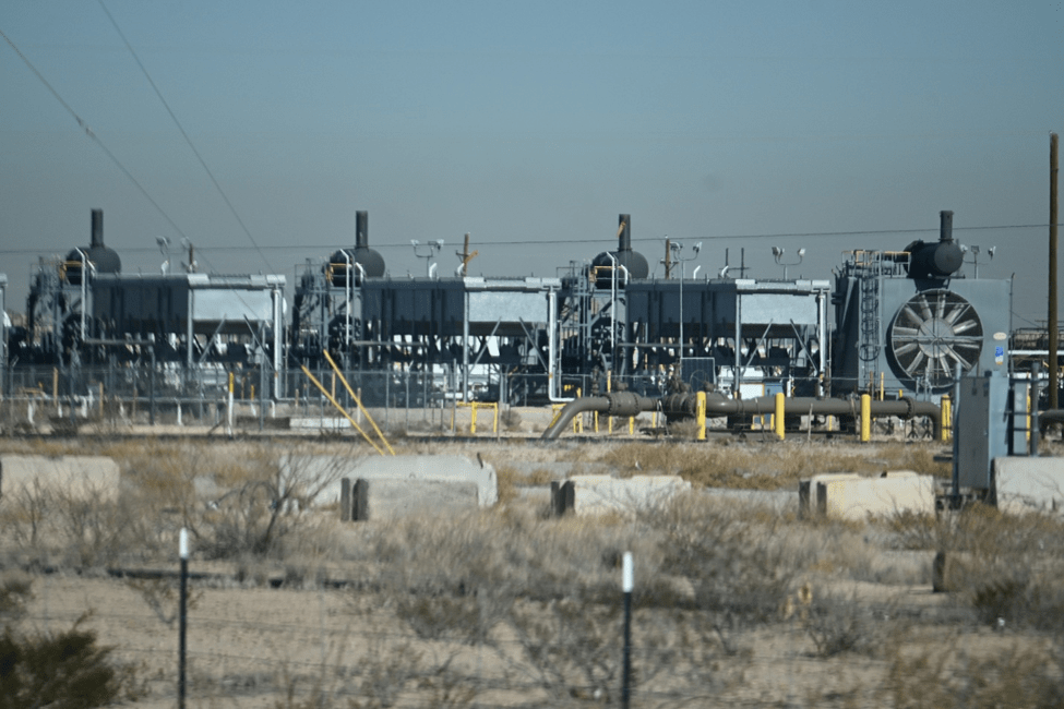
A natural gas compressor plant in the Permian Basin.
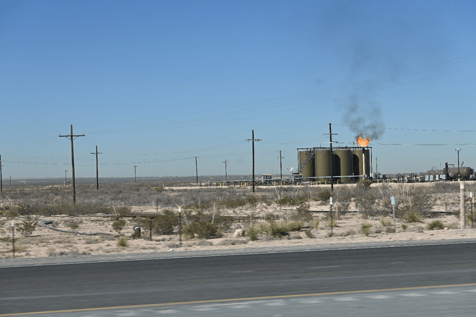
A compressor plant “flaring” natural gas. This is only supposed to happen when there is some sort of malfunction of power loss, but is actually pretty common in the Permian. Burning the natural has is considered preferable to venting the methane, which is a more powerful greenhouse gas than CO2. Flaring also releases SO2 (sulfur dioxide) to the environment, as well as nitrous oxides (NOx), which form air pollutants like acid rain, aerosols and ozone.

Please leave a comment. I will respond.