Being from Wisconsin, I just have to.
Right now we’ve got a lot going on. And it may be part of a pattern.
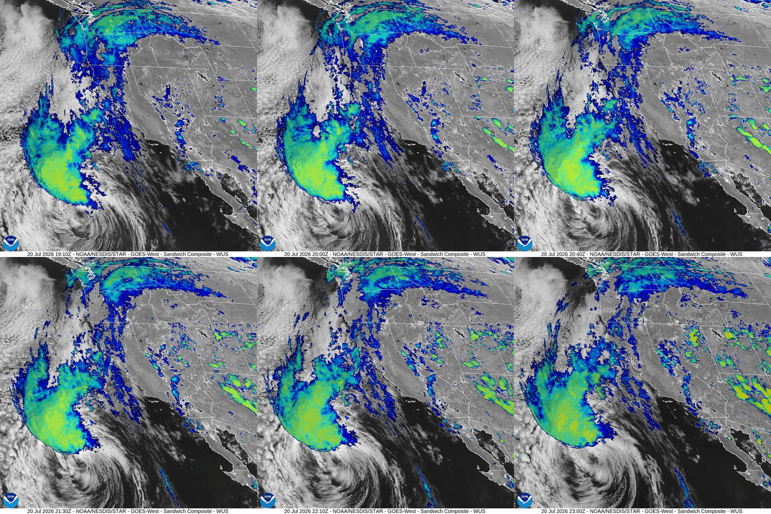
In the east Pacific, Tropical Storm Elida is spinning away obliquely towards northern California. It’s not supposed to have much strength if it does encounter the California coast, even now it has no deep convection, but Elida looks interesting:
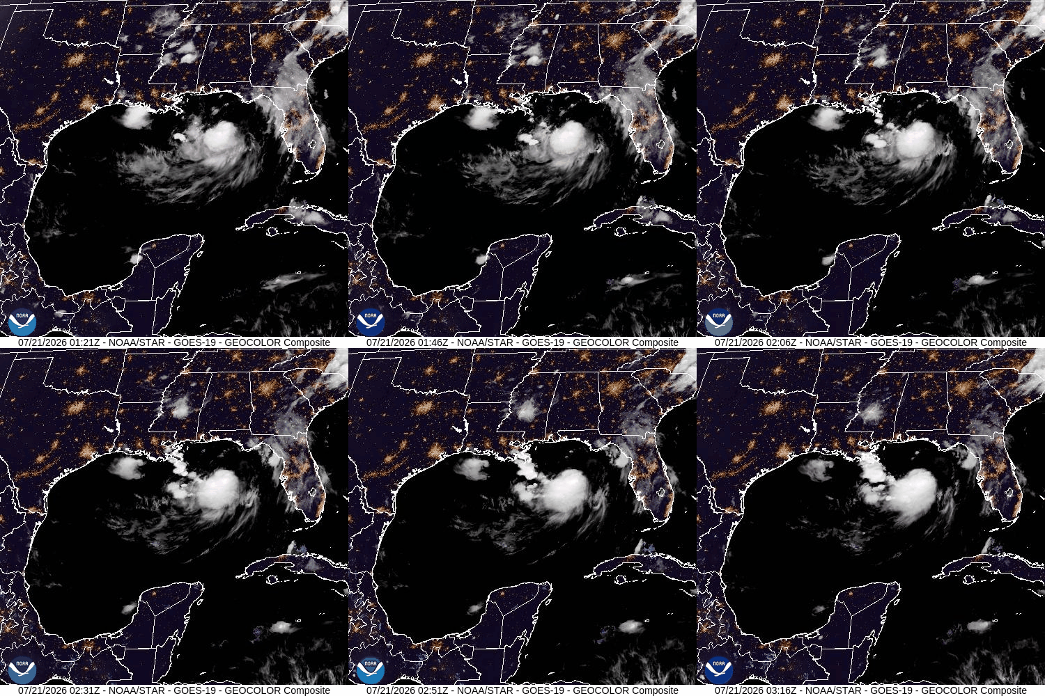
Then we have nascent topical Tropical Storm Bertha in the Gulf, which kind of came out of nowhere, with low shear and a lot of heat. It doesn’t look like much, but has been very persistent. The models aren’t predicting much growth, fortunately.
Next, we have Hurricane Fausto in the east Pacific, trending slowly towards the Hawaiian Islands.
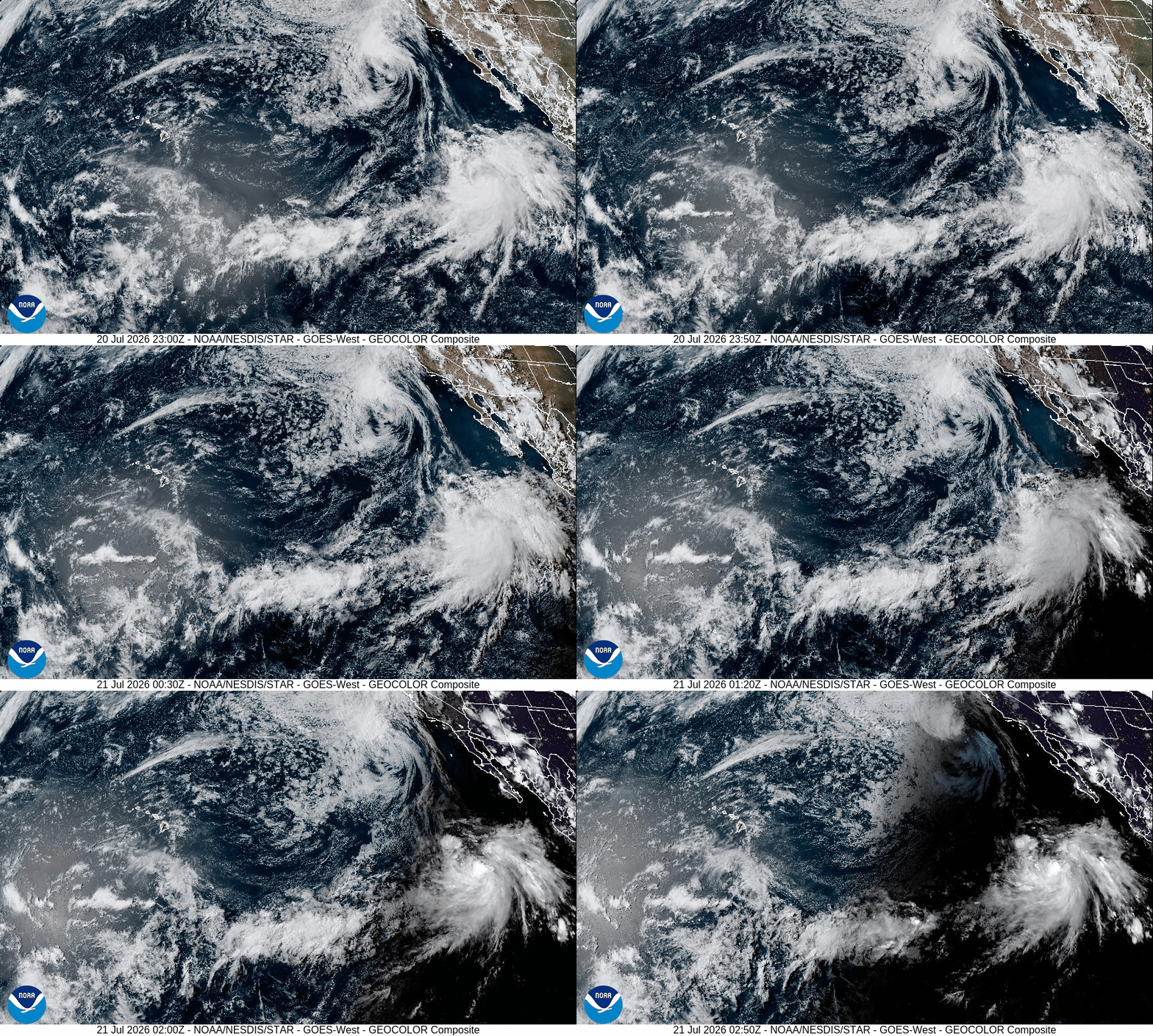
Fausto to the right.
If this is a pattern, it is of more subtropical cyclone development than is normal, which is consistent with the picture of tropical Hadley cell expansion due to human induced climate change. We’ll see.
FYI, NASA predicts a less than average Atlantic hurricane season, based on the El Nino influence of decreased trade winds and overall increased tropical stability. But this might not take into account the increased instability in more subtropical regions.
In any case, it’s all speculation, until it becomes accepted fact. This blog is a process of learning by adapting descriptive and intuitive understanding of natural processes to fit reality better. It’s not perfect, and it will sometimes be wrong.


Please leave a comment. I will respond.